
EVERYDAY TECHNOLOGY · NAVIGATION
How does GPS know where you are?
The satellites never hear your phone; the phone only listens. Each satellite broadcasts the exact time from an atomic clock and where it is. Your phone measures how late each signal arrives, turns every delay into a distance, and only one spot on Earth fits all of them.
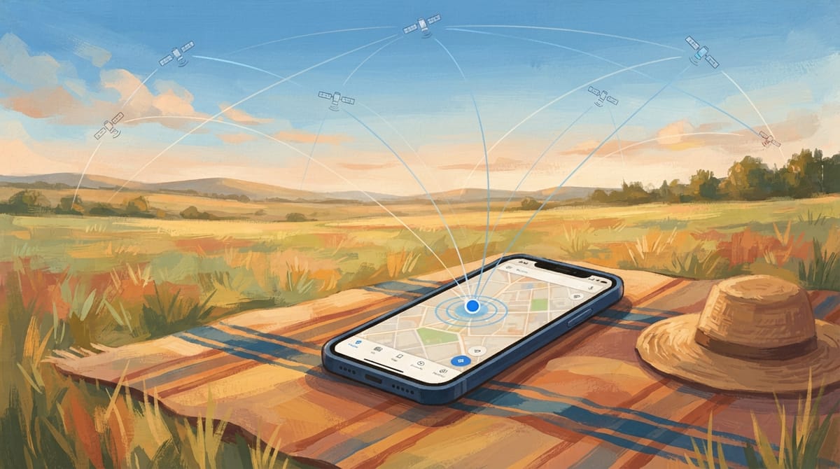
- Satellites broadcast the time
- Delay becomes distance
- Four distances fix one point
Satellites that only broadcast
GPS is a constellation of about thirty satellites, roughly 20,000 km up, each carrying atomic clocks. Every signal they send says two things: the exact moment it left, and where the satellite was at that moment. The signal is one way. Nothing on the satellite knows your phone exists, which is why GPS works for any number of receivers at once and sends nothing back about you.
A common mix-up is that satellites track phones. They do not. All the working out happens in the receiver in your hand.
Read the source: NASA Space Place: How does GPS work?
A delay is a distance
Radio travels at the speed of light, so a signal from a satellite 20,000 km away arrives about 67 thousandths of a second after it left. Your phone compares the time stamped in the signal with its own clock, and multiplies the delay by the speed of light. That is the distance to that satellite.
The phone does not use how strong the signal is, only how late it is. A weak signal from far away and a strong one from nearby are told apart by their timestamps.
Read the source: NASA Space Place: How does GPS work?
One distance is a sphere; three cross at a point
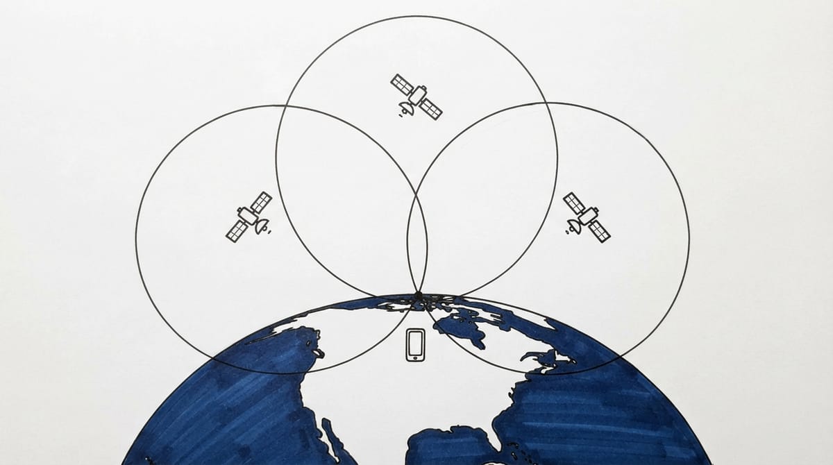
Knowing you are 20,000 km from one satellite puts you somewhere on a sphere of that radius around it. A second distance narrows that to the circle where two spheres meet. A third leaves two points, and one of them is out in space, so the phone keeps the one on Earth. This is trilateration: distances, not angles, which is what makes it different from the triangulation surveyors use.
In the picture the three circles meet at one point on the ground, which is why the method needs several satellites in view at once, not one very good one.
Why a fourth satellite
The catch is the clock in your phone. The satellites keep time to billionths of a second; your phone does not, and a clock error of one millionth of a second is a distance error of about 300 metres. So the phone treats its own clock error as a fourth unknown alongside its three position coordinates, and a fourth satellite gives it the fourth measurement it needs to solve all four at once.
That is also why a receiver with only three satellites in view gives a rough fix at best. Four is the minimum for a trustworthy position; phones usually see more and use them all.
Read the source: GPS.gov: Space segment
Einstein in your pocket, and glass towers
Because the satellites move fast and sit in weaker gravity, their clocks run about 38 millionths of a second a day ahead of clocks on the ground. Left uncorrected, the position error would grow by kilometres every day, so the satellite clocks are built to run deliberately slow to compensate. GPS is one of the few everyday things that stops working if you ignore relativity.
In a city, a signal can bounce off a glass tower before it reaches you. The longer path looks like extra distance, so your dot jumps a street over. Walls do the same indoors: the problem is reflection and blocking, not distance.

A question worth taking into the lesson
“If the phone’s clock is wrong, how can it measure a delay at all?” is the question that unlocks the fourth satellite. Ask Clevaa to draw the four unknowns, then ask what happens to the fix when one satellite drops behind a building.
Then explain it back: a satellite’s signal carries the time and the place it was sent, a delay becomes a distance, spheres cross at a point, and the fourth satellite pays for the cheap clock.
A few useful answers
Does GPS need the internet?
No. The position comes from the satellite signals alone. A data connection helps a phone start faster by downloading where the satellites are, and the map tiles usually need data, but the fix itself does not.
How accurate is a phone’s GPS?
Typically within a few metres under an open sky, and worse between tall buildings or under trees. Phones that listen on two frequencies, and correction services, do better.
Is GPS the only system?
No. Phones also use Europe’s Galileo, Russia’s GLONASS, China’s BeiDou and India’s NavIC, all working on the same principle.
TAKE THE NEXT QUESTION WITH YOU
Turn the explanation into a conversation.
Open this topic in Clevaa, choose a level, and ask the part you want to explore.
Hear GPS explained with pictures ↗You choose when to start. Session availability and usage limits may apply.
Keep exploring
 EVERYDAY SCIENCE · LIGHT
Why is the sky blue?
Air molecules scatter short blue wavelengths far more than red ones, so blue light reaches you from every part of the sky. Why sunsets are red, why clouds are white, and why the sky is not violet.
Explore EVERYDAY SCIENCE · SOUNDHow can adding sound make things quieter?
Learn how microphones, a processor and sound waves make active noise cancellation work, why some sounds remain, and how it differs from passive isolation.
Explore LEARNING YOU CAN LOOK ATSee the idea you are trying to understand.
See ideas take shape with Clevaa, a visual AI tutor. Learn through spoken explanations, illustrations and diagrams, then ask about the part you want to understand.
Explore